
If you have been searching for a free, print ready resource that teaches kids the geography of the United States in a genuinely engaging way, your search is over.
The 50 States Coloring Pages Free Printables created by Blasterjunkies.com is a 50 page PDF packed with detailed, illustrated coloring worksheets for every single U.S. state.
Formatted in standard A4 size, this resource is ready to print straight from home, and best of all, it costs nothing.
This blog post breaks down exactly what is inside the document, what makes it special as a learning tool, and how parents and teachers can get the most out of it with kids.
What Is This PDF, Exactly?
At 50 pages, the document opens with a bold cover page and a terms of use page, followed by 50 individual state worksheets one per state, arranged in alphabetical order.
The pages are formatted in landscape orientation on A4 paper, making them easy to print at home on any standard inkjet or laser printer.
The file size is approximately 61 MB, which reflects the high quality illustrations packed into every page.
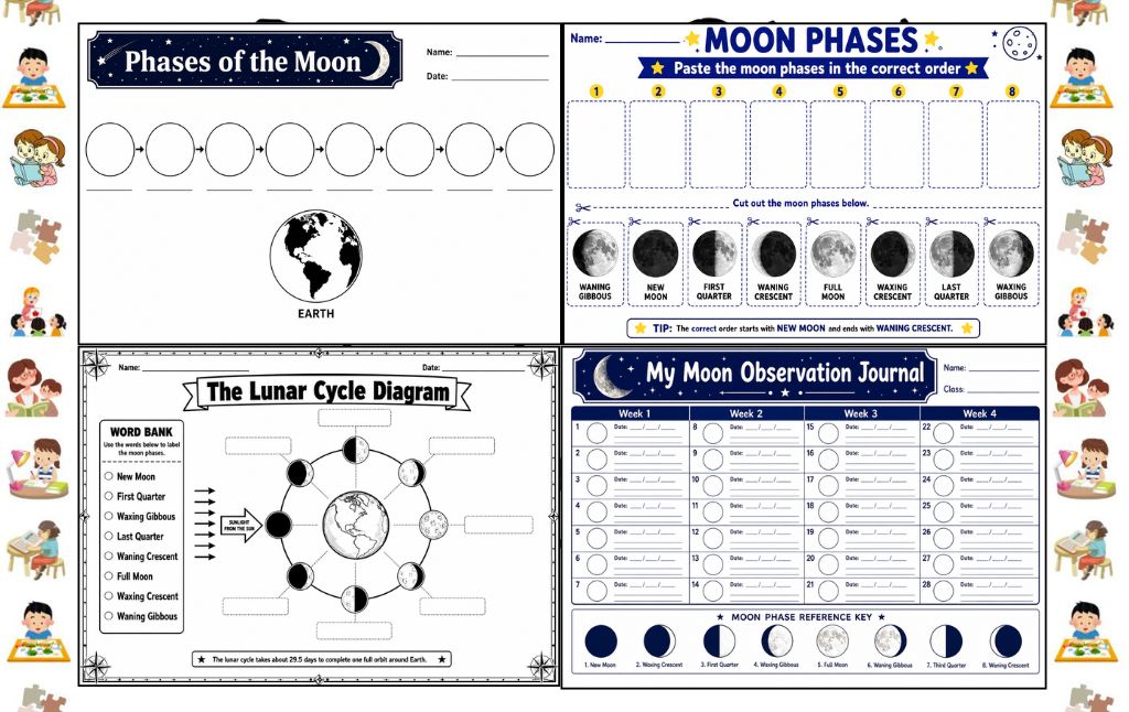
10 Phases of the Moon Worksheets: A Complete Guide for Parents and Teachers
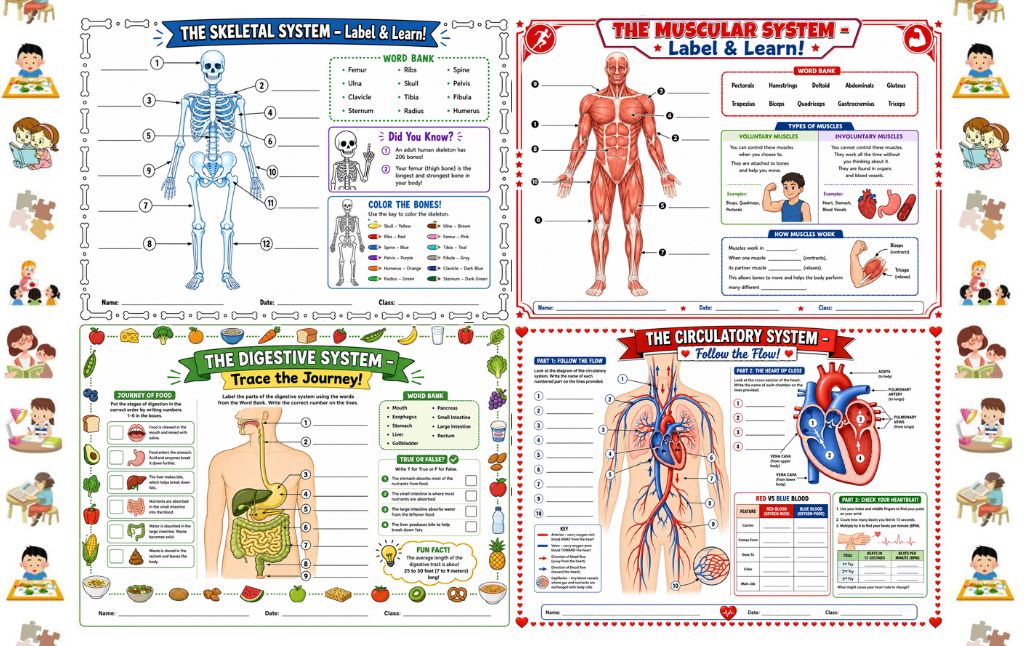
10 Free Human Body Systems Worksheets for Kids: A Complete Guide for Parents and Teachers
10 Fun Camping Themed Do a Dot Printables to Download
What Does Each Page Look Like?
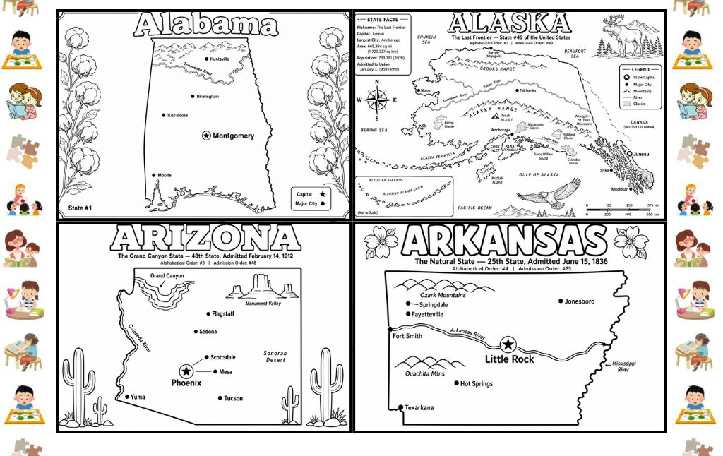
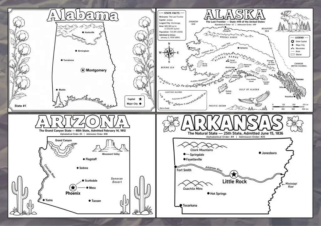
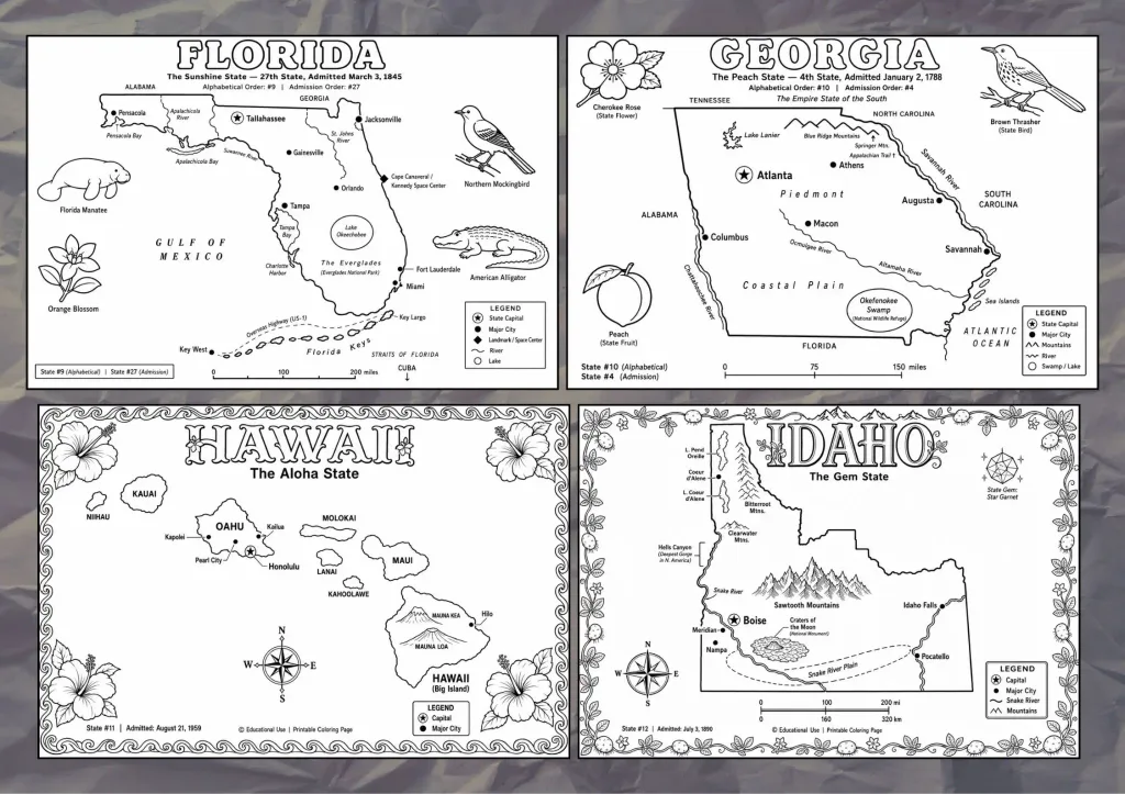
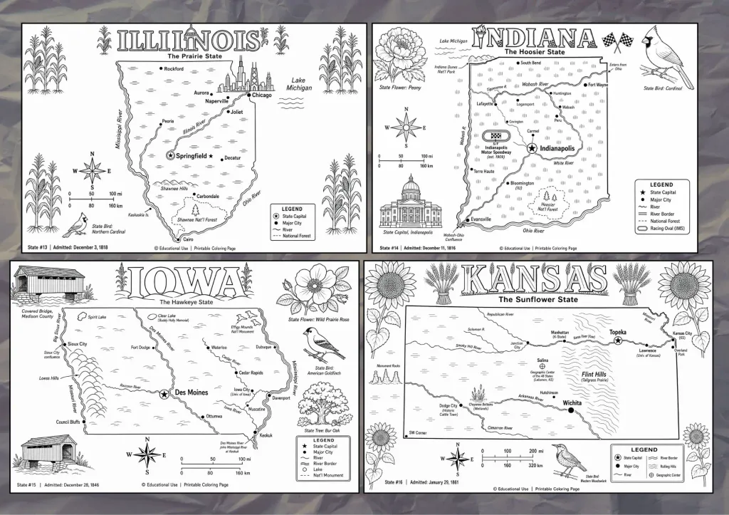
This is where the resource truly shines. Each state worksheet is not simply a blank outline of a state’s shape.
Every page is a rich, information dense illustration that combines geography, history, and natural science into a single coloring activity.
Here is a detailed breakdown of every visual element you will find on a typical page:
The State Name as a Coloring Title Each page features the state’s name rendered in large, bold, outline lettering designed specifically to be colored in by children.
The letters are thick and clearly spaced, making them suitable for younger kids with crayons as well as older children using fine tipped colored pencils.
The State Map with Labeled Cities A large, clean outline map of the state sits at the center or lower half of each page.
Major cities are marked with a dot, while the state capital is distinguished by a star symbol.
Rivers, mountain ranges, bodies of water, and neighboring states are also labeled directly on the map, giving children a real sense of geography and spatial awareness as they color.
A Detailed Map Legend Every map includes a legend or key that explains the symbols used differentiating between the state capital, major cities, rivers, lakes, county boundaries, historic sites, glaciers, mountain peaks, and more.
Teaching children to read a map legend is a foundational geography skill, and this worksheet builds that understanding naturally through the coloring activity.
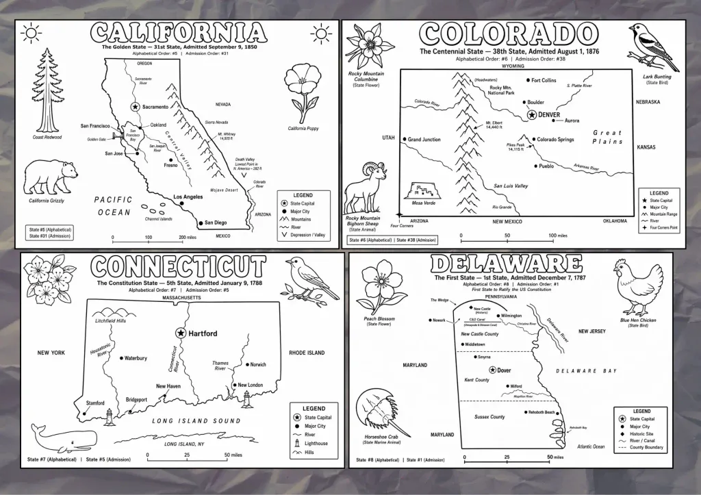
State Facts Panel Most pages include a compact facts box that lists key data about the state such as the state nickname, the capital city, the largest city, the total area, the population, and the date it was admitted to the Union.
For example, one page notes alphabetical order, admission order, and the year of statehood. These bite sized facts are perfect for older kids to read aloud or memorize.
State Symbols as Illustrated Characters One of the most charming features of the more detailed pages is the inclusion of illustrated state symbols surrounding the map.
You will find drawings of the state bird, state flower, and state animal all rendered as outline illustrations ready to be colored.
These illustrations are detailed enough to be genuinely informative; children can look at the image and understand what the symbol looks like in real life, making the coloring experience both artistic and educational.
Compass Rose and Scale Bar Many pages include a compass rose indicating North, South, East, and West, as well as a scale bar showing distance in miles and kilometers.
These elements introduce children to two more core cartography concepts in a completely accessible, hands on way.
Decorative Themed Borders (Earlier Pages) The cover and introductory pages feature a playful border of cartoon children reading, playing with puzzles, and engaging in learning activities reinforcing the fun, classroom friendly tone of the entire collection.
Two Distinct Page Styles Inside the Collection
As you flip through the PDF, you will notice that the worksheets are not all identical in format. There are two main visual styles at play:
Style 1 The Simplified Map (e.g., Alabama)
These pages are clean and less cluttered, featuring the outline map, capital and city labels, a simple legend, and the decorative state symbol border.
The emphasis is on coloring the map itself.
This style works especially well for younger children aged 5 to 8, who benefit from fewer labels and more open white space for coloring.
Style 2 The Detailed Geographical Map (e.g., Alaska, Delaware, Florida)
These pages are significantly more information rich.
They include mountain ranges, rivers, national parks, historical landmarks, state symbols as illustrated images, a facts panel, a compass rose, and a scale bar.
The text is smaller, the map is more complex, and the coloring areas are more intricate. This style is ideal for children aged 8 and up, and is particularly suitable for middle school geography lessons or independent study.
This built in variety means the same PDF can serve children across a wide age range without feeling too easy or too challenging.
How to Use These Coloring Pages With Kids
Getting the most out of this resource is all about context.
A coloring page on its own is enjoyable, but paired with a structured activity, it becomes a powerful learning experience.
Here are several practical ways to use these worksheets at home and in the classroom.
Start a 50 States Coloring Journal
Print all 50 pages and bind them into a personal booklet for each child.
As the family or class “visits” each state whether through a road trip, a documentary, a book, or a news story the child colors in the corresponding page and adds their own notes around the margins.
By the end of the year, each child has a handmade reference book of the entire United States.
Use Them as Geography Quiz Prep
Before a geography test, give children a blank state worksheet and challenge them to fill in as many city names, river names, and facts as they can from memory.
Then hand over the completed worksheet to check their answers.
The act of writing and coloring reinforces memorization far more effectively than flashcards alone.
One State Per Week Curriculum
For homeschool families, this PDF supports a structured “one state per week” curriculum.
Each week, the child colors the worksheet, researches the state bird and flower (which are illustrated on the page), and completes a short writing assignment about something interesting they learned.
By the end of the school year, all 50 states are covered.
Color Code by Region Give children a color scheme and ask them to color each state according to its U.S.
region for example, blue for Northeast states, green for Midwest, orange for South, and yellow for West.
This simple activity builds an understanding of regional geography and introduces the concept of thematic mapping.
Practice Reading Map Legends
Before a child starts coloring, ask them to read the map legend aloud and explain each symbol.
Then, as they color, prompt them to point out where the capital is, where the largest river flows, and where the state borders its neighbors.
This turns the coloring session into an active geography discussion.
Use the State Facts as Conversation Starters
The facts panels on the detailed pages are goldmines for curious questions. “Why is Delaware called the First State?” or “Why is Alaska so much bigger than every other state?”
These questions lead naturally into short research sessions, library visits, or YouTube rabbit holes all sparked by a single coloring page.
What Age Group Is This Best For?
The PDF works across a surprisingly wide range.
The simplified map pages are accessible for children as young as 5 or 6, who can color the large open shapes and practice writing the state name by tracing the bold letters.
The detailed map pages with their state symbols, facts boxes, and compass roses are engaging and challenging enough for children aged 10 to 13.
This makes the collection genuinely useful for early elementary through middle school.
Practical Printing Tips
Since the pages are in landscape orientation on A4 paper, make sure your printer settings match before you print.
Set page orientation to landscape and ensure scaling is set to “fit to page” rather than “actual size” to avoid any content being cut off at the margins.
The clean black and white line art prints beautifully on plain copy paper, but if you want the pages to last longer and withstand heavy coloring, a slightly heavier 90 gsm paper makes a noticeable difference.
For classroom use, laminating a set of the most popular pages and providing dry erase markers creates a reusable activity station.
Final Thoughts
The 50 States Coloring Pages Free Printables is one of those rare free resources that genuinely over delivers.
The combination of detailed illustrated maps, state symbols, geographic labels, facts panels, and compass roses makes each page a complete mini lesson in itself.
Whether you are a homeschool parent building a year long geography curriculum, a classroom teacher looking for a low prep enrichment activity, or simply a parent who wants to keep curious kids engaged on a rainy afternoon, this PDF earns a permanent spot in your printables folder.
Download it, print it, and watch your kids discover just how fascinating all fifty states really are.
[ >> DOWNLOAD THE 50 STATES COLORING PAGES FREE PRINTABLES HERE << ]
10 Adorable Dinosaur Dot Activities to Print Today
Free Reading Reward Charts for Kids Who Love Books
10 Colour Free Printable Reward Charts
10 Page Color Printable Brain Teaser Bundle
Grocery List Templates Printable Free
How to Use “Open When” Letters to Support Your Chil
Leave a Reply