This collection of Printable Blank Maps for Kids is a comprehensive 21 page geography resource designed for students, teachers, and homeschoolers. These A4 sized worksheets provide a structured way for children to learn world geography, ranging from identifying the seven continents to mastering specific countries and US states.
The pack is strategically designed with paired worksheets: one labeled version for study and reference, and one blank version for testing and practice.
Detailed Breakdown of the Worksheets
The World View (Pages 3–4)
- Labeled Continent Map: Introduces the seven continents (North America, South America, Europe, Africa, Asia, Australia, and Antarctica).
- Task: Children color-code each continent to help with visual recognition.
- Blank Continent Map: A “test” version where children must independently label the continents and color them according to a provided list.
Africa (Pages 5–6)
- Detailed Map: Shows all countries, from Algeria to South Africa, including island nations like Madagascar.
- Outline Map: Features political borders only, allowing kids to practice locating specific countries like Egypt, Nigeria, or Kenya.
Antarctica (Pages 7–8)
- Detailed Map: Uniquely identifies ice shelves (Ross, Ronne), seas (Weddell, Ross), and major regions (Queen Maud Land, Wilkes Land).
- Outline Map: A blank version for labeling the unique frozen geography of the South Pole.
Asia (Pages 9–10)
- Detailed Map: Includes a massive range of countries. Because many are small, it features a Letter Key (A–U) for regions like the Middle East and Southeast Asia.
- Outline Map: A blank grid of borders to test knowledge of the world’s largest continent.
Australia/Oceania (Pages 11–12)
- Detailed Map: Focuses on the continent of Australia and the surrounding islands of Indonesia, Papua New Guinea, and New Zealand.
- Outline Map: Perfect for learning the relationship between mainland Australia and the neighboring island nations.
Europe (Pages 13–14)
- Detailed Map: Due to the high density of countries, this map uses a comprehensive Letter Key (A–U) to identify smaller nations like Belgium, Croatia, and the Baltic states.
- Outline Map: Challenges students to identify complex European borders.
North America (Pages 15, 16, 19)
- Continental View: Focuses on Canada, the USA, Mexico, Greenland, and Central American nations.
- Detailed & Blank Versions: Students learn to distinguish between the large northern nations and the smaller countries to the south.
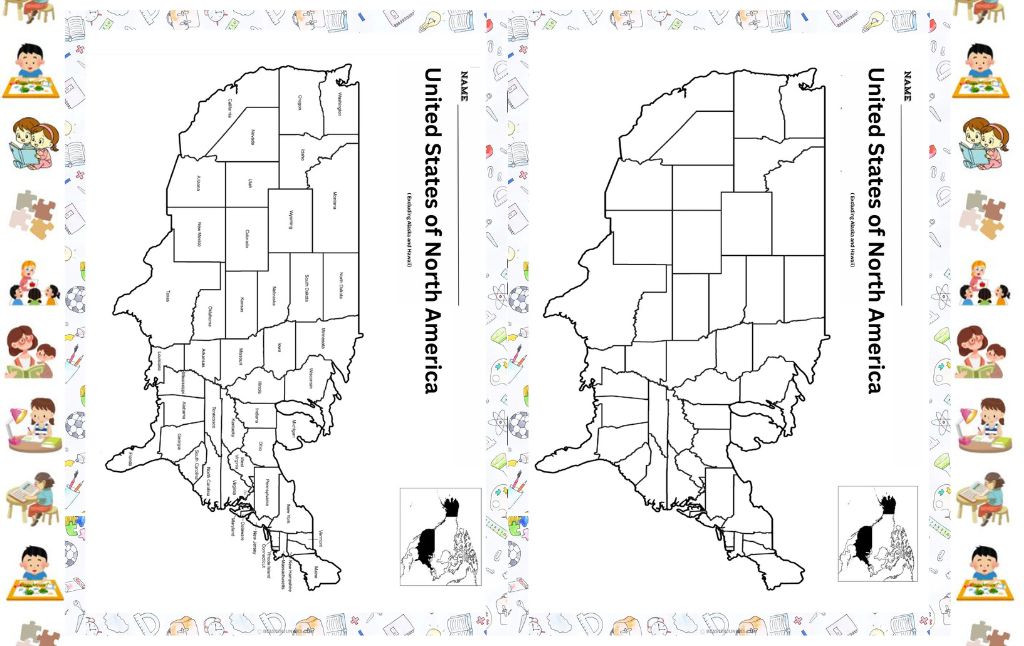
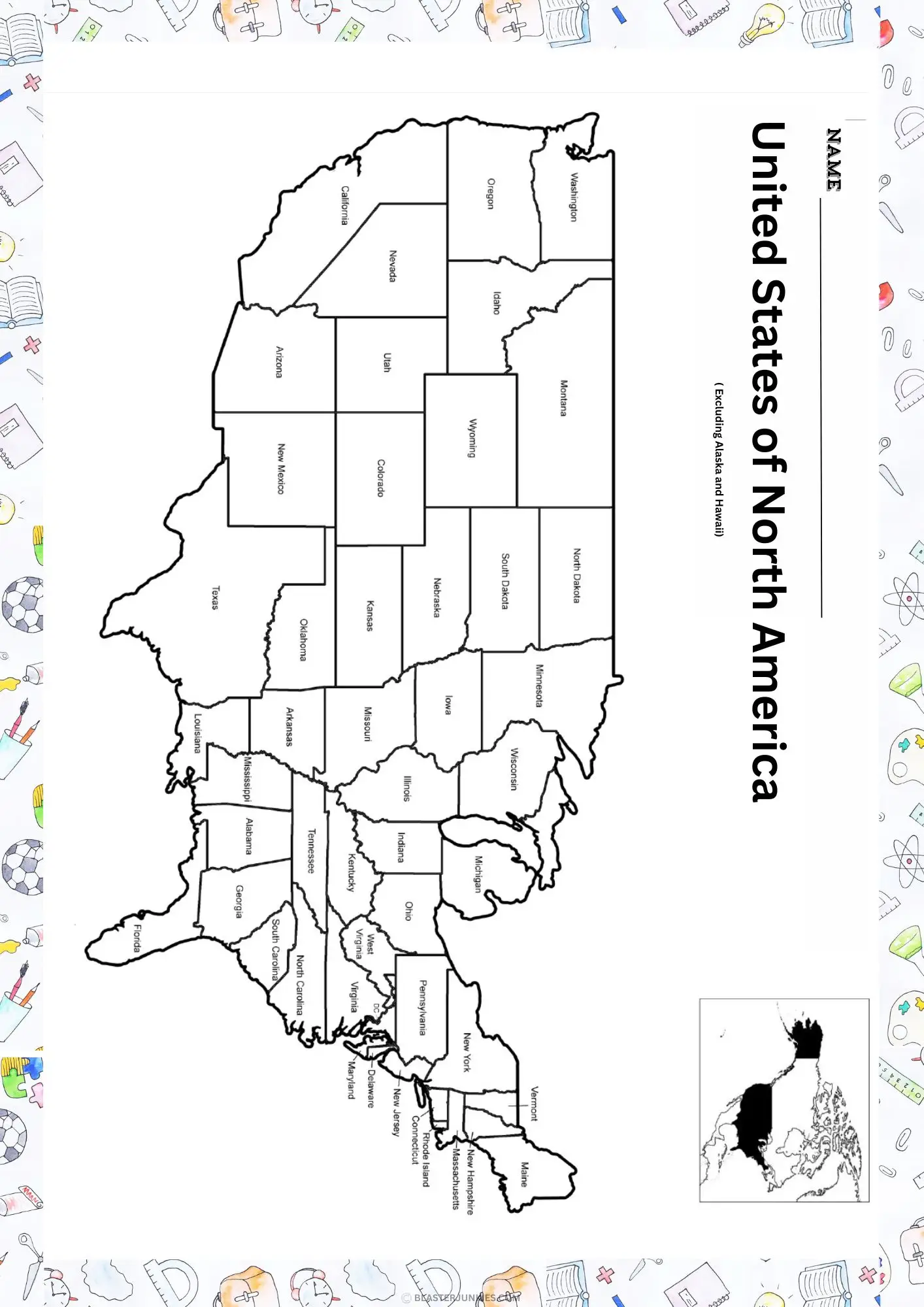
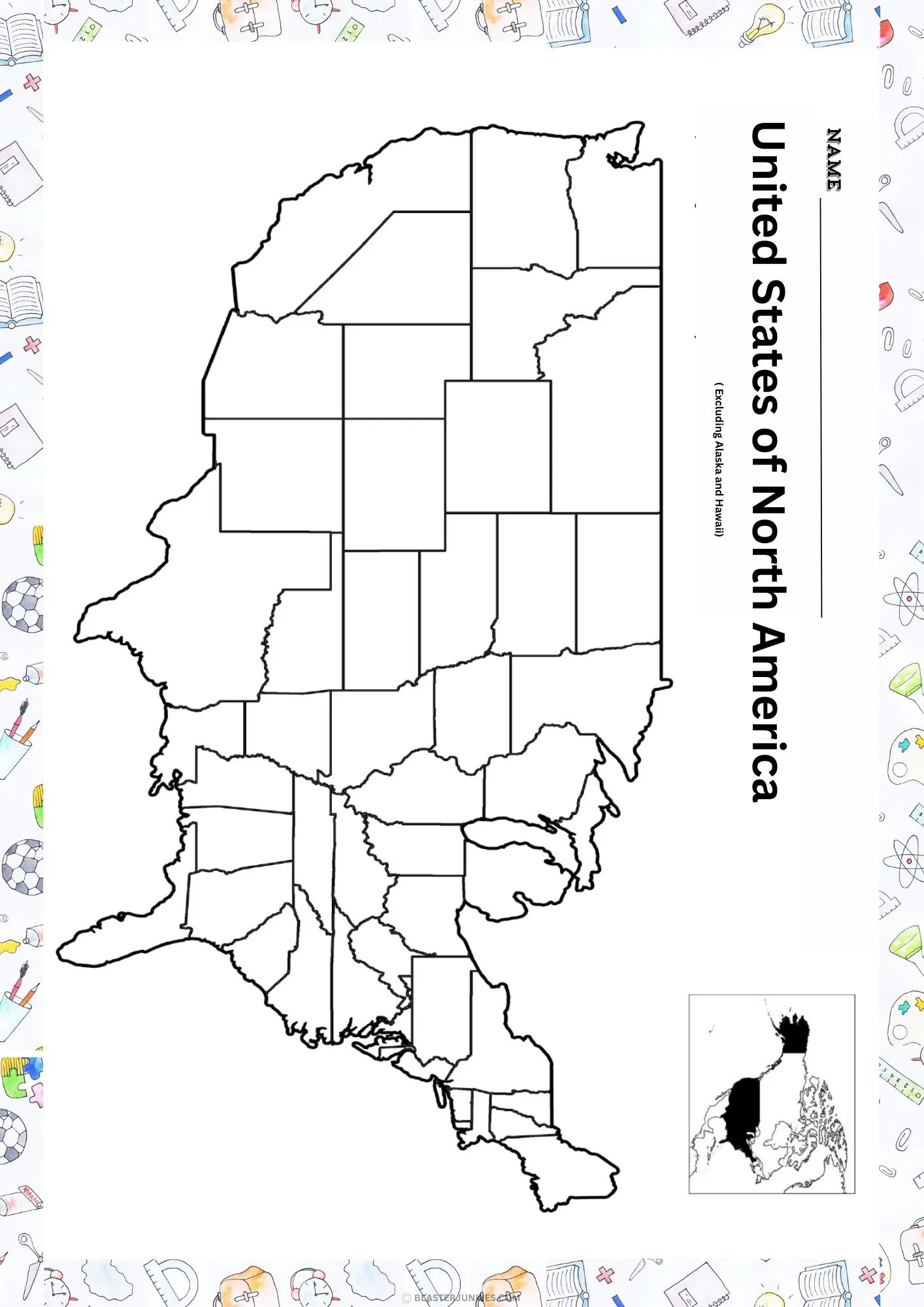
United States (Pages 17–18)
- Lower 48 Map: A dedicated map showing all 48 contiguous states with their names.
- Blank State Border Map: An excellent tool for “state identification” quizzes where students fill in the names of the states.
South America (Pages 20–21)
- Detailed Map: Labels nations from Colombia down to Chile and Argentina.
- Outline Map: A simple border map for testing country locations.
How to Use These Maps for Learning
Step 1: The “Study and Compare” Method
Give the child both the labeled and blank versions of a specific continent. Have them look at the labeled version for 5 minutes, then attempt to fill in as much of the blank version as they can from memory. They can then “check their work” using the labeled sheet.
Step 2: Color Coded Categorization
Use specific colors for different categories to aid memory. For example:
- Color all coastal countries Blue.
- Color all landlocked countries Yellow.
- Color the largest country in the continent Red.
Step 3: Geography “Passport” Project
If using these in a classroom, have students pick one continent per week. They can color the blank map, and on the back, write three interesting facts about the culture or animals found in that region.
Step 4: The “Mystery Country” Game
Parents or teachers can point to a random country on the blank outline map and ask, “What country is this?” or “What is the capital of this country?” This builds quick-recall skills.
Step 5: Master the US States
Use pages 17 and 18 for a timed challenge. See if the student can label all 48 states in under 10 minutes. This is a classic elementary school milestone that these maps make easy to practice.
Printing Tips
Standard A4: These files are optimized for A4 paper.
Personal Use: As per the terms on page 2, these are for personal or classroom use only.
Lamination: For the blank maps, consider laminating them. Children can then use dry erase markers to label and erase, allowing for endless practice without wasting paper.
Download the high resolution A4 PDF bundle
ABC Letter Tracing Alphabet Activity Worksheets
Alphabet Letter Sound Activity Cards
Free A to Z Alphabet Hat Crafts: Printable Letter Learning Activities.
Zoo Animal Scavenger Hunt Worksheets
The Ultimate Shapes Bundle: Free Printables for Circle, Triangle, Square, and Rectangle.
Neighborhood Water Cycle Worksheet Pack
Educational Easter Activities Neighborhood Scavenger Hunt for Kindergarten & Elementary.